

Geography, 09.09.2021 23:40, carlybeavers50
HELP
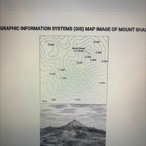
The images show a topographic map and a geographic information systems parentheses GIS parentheses representation of mount Shasta in California. Which of the following statements best explains why these printed images are geometrically distorted representations of earths surface?
A Some maps do not show the actual coloration of earths surface and vegetation
B GIS can only display two dimensional layers
C The planets gravitational poles are not located at the poles of earths axis
D three dimensions of earths surface are displayed on two dimensional page
E printed Maps alter the sense of place that people can have about a location

Answers: 3


Other questions on the subject: Geography
Geography, 22.06.2019 16:50, dinajathomas0407
Which of the following is not a challenge to instituting sound global environmental policies? a. most changes are inexpensive and easy to implement. b. elected leaders who support unpopular environmental issues often are not re-elected. c. economic considerations outweigh environmental ones in many societies. d. there is no way to enforce international environmental agreements.
Answers: 2
Geography, 23.06.2019 07:30, Yeetadab1974
Which was not a country that massively built up its navy in the early 1900s? germany china united statesbritain
Answers: 1
Geography, 23.06.2019 19:20, BrownieMan123
Soil color only reflects the amount of organic matter present in soil.
Answers: 1
Geography, 24.06.2019 02:30, joThompson
What does the map above tell us about the endemity of typhoid fever
Answers: 1
Do you know the correct answer?
HELP
The images show a topographic map and a geographic information systems parentheses GIS parent...
Questions in other subjects:


Mathematics, 21.05.2020 15:58

Chemistry, 21.05.2020 15:58
Mathematics, 21.05.2020 15:58
Geography, 21.05.2020 15:58
Mathematics, 21.05.2020 15:58


