

Geography, 09.11.2019 03:31, anayajhughes0603
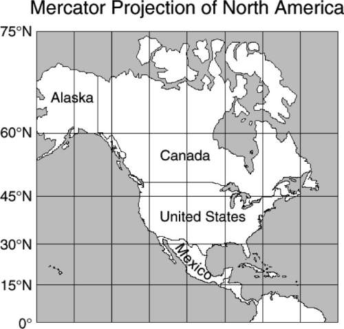
In this mercator map of north america, canada and alaska together appear larger than the united states and mexico together when in fact they are smaller. what causes this distortion?
f the map is a projection of a round world onto a flat surface.
g the latitude and longitude lines create an optical illusion.
h the northern regions are enlarged because the shallower
parts of the ocean are frozen.
j mountains get flattened on a map so that mountainous
areas look larger than they really are.

Answers: 2


Other questions on the subject: Geography
Geography, 22.06.2019 21:00, blessing03
When you cross a time zone going east what happens to the time
Answers: 1
Geography, 23.06.2019 11:00, chaseashley24
Triangle with the the sides 72 and 75 and x. also other trsingle withsides 24 25 and 7. what is the value of x.
Answers: 1
Geography, 23.06.2019 16:00, meaddestinee
The graph below plots the temperature and luminosity of stars on the main sequence.
Answers: 1
Do you know the correct answer?
In this mercator map of north america, canada and alaska together appear larger than the united stat...
Questions in other subjects:


Advanced Placement (AP), 06.11.2020 21:30
Mathematics, 06.11.2020 21:30

Biology, 06.11.2020 21:30

Health, 06.11.2020 21:30
Mathematics, 06.11.2020 21:30

SAT, 06.11.2020 21:30

Chemistry, 06.11.2020 21:30

World Languages, 06.11.2020 21:30


