

VERY EASY!!Use Microsoft word
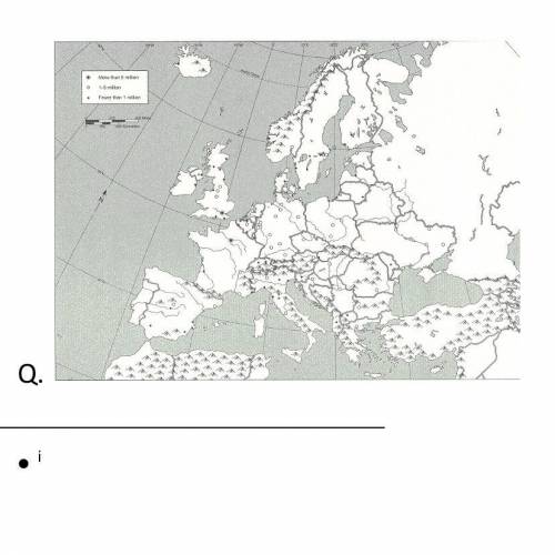
Use BLACK INK and the corresponding numbers to label the following European landforms. You can look on the internet for guidance. Color according to the type of landform listed below. When you have finished labeling and coloring all landforms, color the remaining land yellow.
*Remember: There should be no white areas on your map.*
Bodies of Water: Blue
1.Adriatic Sea
2.Atlantic Ocean
3.Baltic Sea
4.Black Sea
5.English Channel
6.Mediterranean Sea
7.North Sea
8.Strait of Gibraltar
Peninsulas: Green
9.Balkan
10.Iberian
11.Italian
12.Jutland
13.Scandinavian
Mountain Ranges: Brown
14.Alps
15.Apennines
16.Balkans
17.Pyrenees
18.Urals
Rivers: Red
19.Danube
20.Rhine
21.Seine
22.Thames
Other: Purple
23.Northern European Plain
24.Black Forest
European Political Features
Use BLACK INK and the corresponding letters to label the following cities and countries. Write the names of each country’s capital ONLY where it is requested.
A. Austria
B. Belgium
C. Czech Republic
D. England CAPITAL:
E. France CAPITAL:
F. Germany CAPITAL:
G. Ireland
H. Italy CAPITAL:
I. Netherlands
J. Poland
K. Portugal
L. Romania
M. Slovakia
N. Spain CAPITAL:
O. Sweden
P. Switzerland

Answers: 1


Other questions on the subject: Geography
Geography, 22.06.2019 01:00, bglosson4333
"water seeps into rock cracks and dissolved minerals there. the solution travels through cracks in the. eventually concentrating into large crystals." which process is that
Answers: 1
Geography, 22.06.2019 17:30, sparky1234
Asap! ! ! western china, northern china and southeastern mongolia are all located in what climate zone? tropical wetdesert humid subtropical humid continental
Answers: 2
Geography, 22.06.2019 19:00, bneilesauger
Sandstones that form in aeolian (wind/desert) environments appear very different from other sandstones, such as those formed in a beach/ shoreline environment and in rivers on land. give three identifying properties for each of the three sandstones that would tell a geologist which depositional environment they formed in. consider things such as the relationship between transportation and grain size, shape, roundness, sorting, fossils and composition.
Answers: 2
Geography, 23.06.2019 00:20, leapfroggiez
If scientists only detect p waves in a certain layer of earths interior what does that tell us?
Answers: 1
Do you know the correct answer?
VERY EASY!!Use Microsoft word
Use BLACK INK and the corresponding numbers to label the following Eu...
Questions in other subjects:

Computers and Technology, 25.02.2021 23:40

Arts, 25.02.2021 23:40

Mathematics, 25.02.2021 23:40
Mathematics, 25.02.2021 23:40

Mathematics, 25.02.2021 23:40

World Languages, 25.02.2021 23:40

Biology, 25.02.2021 23:40
Mathematics, 25.02.2021 23:40


