

Geography, 27.09.2019 02:30, friendsalwaysbae
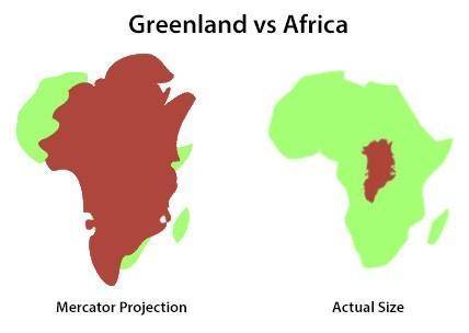
Schools in greenland want to use a map that shows their country larger in relation to other countries and continents in the world. which would be the best map projection for the schools to choose? a mercator map projection a peter map projection a robinson map projection a homolosine map projection an azimuthal map projection

Answers: 1


Other questions on the subject: Geography
Geography, 22.06.2019 18:00, shakkahdbwjsjs3068
How long does it take hair to grow 8 inches?
Answers: 2
Geography, 23.06.2019 02:10, springcoates
What first caused people to consider that the continents were once one large landmass?
Answers: 1
Do you know the correct answer?
Schools in greenland want to use a map that shows their country larger in relation to other countrie...
Questions in other subjects:

Mathematics, 19.01.2021 20:40

Computers and Technology, 19.01.2021 20:40


History, 19.01.2021 20:40

History, 19.01.2021 20:40

Mathematics, 19.01.2021 20:40


