


Question 71 (1 point)
deep-ocean trenches mark the sites where lithospheric plates are subduct...

Geography, 23.08.2019 04:20, Vetinthemaking21
Question 71 (1 point)
deep-ocean trenches mark the sites where lithospheric plates are subducting back into the mantle.
question 71 options:
true
false
question 72 (1 point)
clastic particles in a sedimentary breccia are rounded and are about the same size as fine-grained sand.
question 72 options:
true
false
question 73 (1 point)
the first sign of a tsunami's approach is a rapid retreat of water from the shoreline.
question 73 options:
true
false
question 74 (1 point)
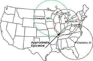
you are monitoring a seismograph in seattle. one morning, your instrument records an earthquake approximately 2000 km away. from that information, can you determine where the earthquake occurred?
question 74 options:
yes, because seismographs can indicate direction as well as distance.
no, because seismographs can't pick up earthquakes from that far away.
yes. you could take the distance and match it up with known fault lines to find the epicenter.
no, because you would need information from more than one seismograph to plot the epicenter.

Answers: 3
Other questions on the subject: Geography
Geography, 23.06.2019 16:20, xcncxgnfxg6487
Which of the following mountain ranges is home to the largest mountain peak in europe? a. the carpathian mountains b. the caucasus mountains c. the balkan mountains d. the ural mountains select the best answer from the choices provided a b c d
Answers: 3
Geography, 24.06.2019 09:00, bakaoffire
In the scramble for africa, european powers drew boundaries and created states that benefitted the colonizers while ignoring the needs of the local populations. what effects did this policy have on the indigenous people following independence?
Answers: 1
Do you know the correct answer?
Questions in other subjects:

Mathematics, 28.11.2021 19:00


Arts, 28.11.2021 19:00
Mathematics, 28.11.2021 19:00
Mathematics, 28.11.2021 19:00


World Languages, 28.11.2021 19:00


