

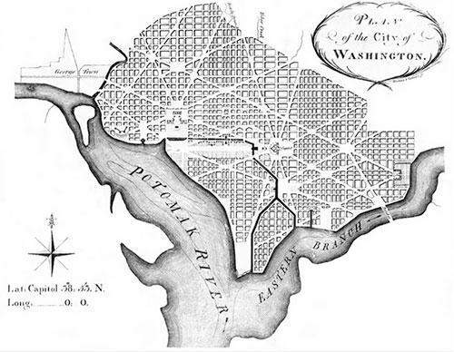
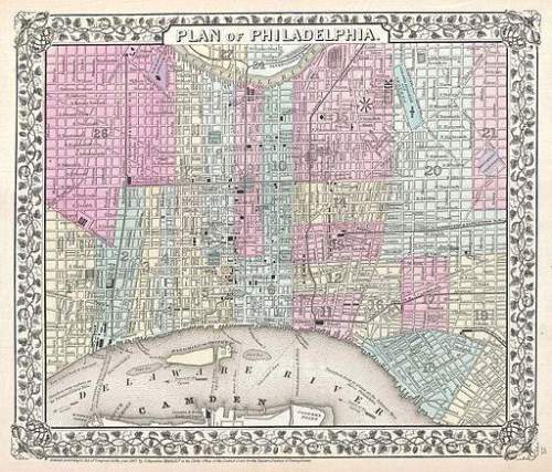
This map (down below in black and white), from 1792, is a plan for the city of washington d. c. how is it related to philadelphia? (map in color)
both cities were planned by charles l'enfant.
both cities were built at the intersection of major rivers.
both cities were constructed in the late 1700s.
both cities were planned using the grid system.

Answers: 1


Other questions on the subject: Geography
Geography, 23.06.2019 16:40, btaylor1179
To obtain a microcredit loan, a person typically must a. be a male and have a source of income b. provide collateral and sign paperwork c. verbally promise to pay back the money d. have a good credit history select the best answer from the choices provided. a b c d
Answers: 2
Geography, 24.06.2019 11:50, pmdare2551
According to the sector model, in which region or regions would you most likely find industrial and transportation development?
Answers: 2
Do you know the correct answer?
This map (down below in black and white), from 1792, is a plan for the city of washington d. c. how...
Questions in other subjects:

English, 05.02.2021 04:20


Mathematics, 05.02.2021 04:20

Advanced Placement (AP), 05.02.2021 04:20
Mathematics, 05.02.2021 04:20

Computers and Technology, 05.02.2021 04:20


